

The spectacular Selkirks host this stunning alpine mountain bike ride into the Keystone and Standard Basins. The trailhead is reached by driving on a highway for about 45 minutes north of Revelstoke, then a further approximately 45 minute drive up a well maintained forest service road that is suitable for most vehicles, even low clearance 2wd vehicles. See full driving directions and best time to ride in the BETA below!

The trailhead has lots of parking space, although many visitors choose to carpool from Revelstoke. The trailhead has a beautiful sturdy outhouse to use before you head off!
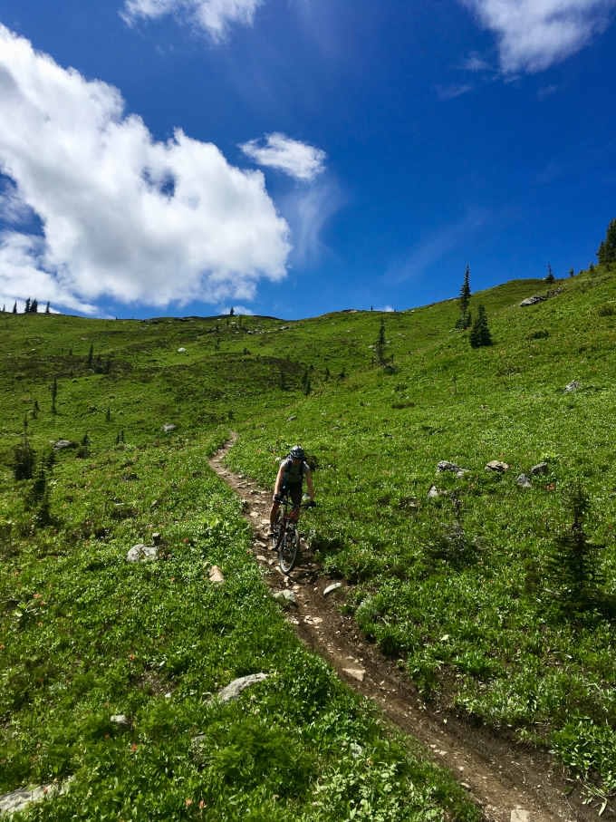
The Keystone Standard Basin trail weaves through the gorgeous Keystone alpine basin for 11km before reaching an old unusable cabin, and features several stunning vistas along the journey. The trail is mostly rideable for advanced mountain bikers, with some steeper hike-a-bike sections. The Keystone Standard Basin trail is also popular with trail runners and hikers.
Most mountain bikers choose to turn around and head back to the trailhead from the cabin at the 11km point, while some carry on a much rougher trail to reach Standard Basin. Plan 3-5 hours for a round trip to the cabin and be prepared for the mountain environment! Add on another 3-5 hours for Standard Basin and/or the Standard Peak hike-a-bike.

Gliding along the Keystone trail 
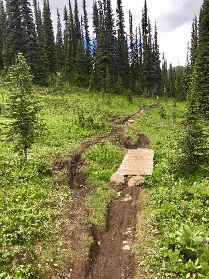
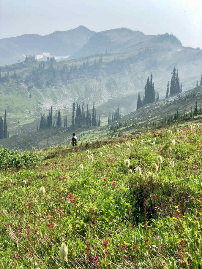
Alpine bog section on the Keystone trail 
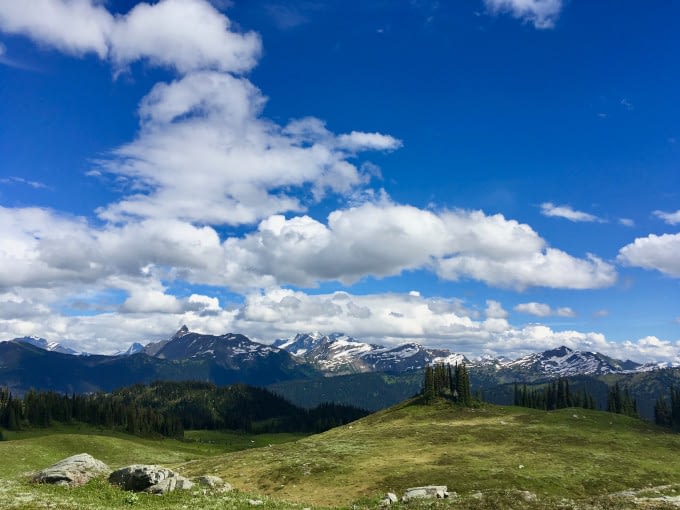
Keystone Basin vista
If you are new to the area or a newer mountain biker, consider trying the Frisby Ridge trail as your first alpine biking experience as it is purpose built for mountain biking and more suitable for intermediate mountain biking ability levels.

Rest stop at the Keystone cabin 
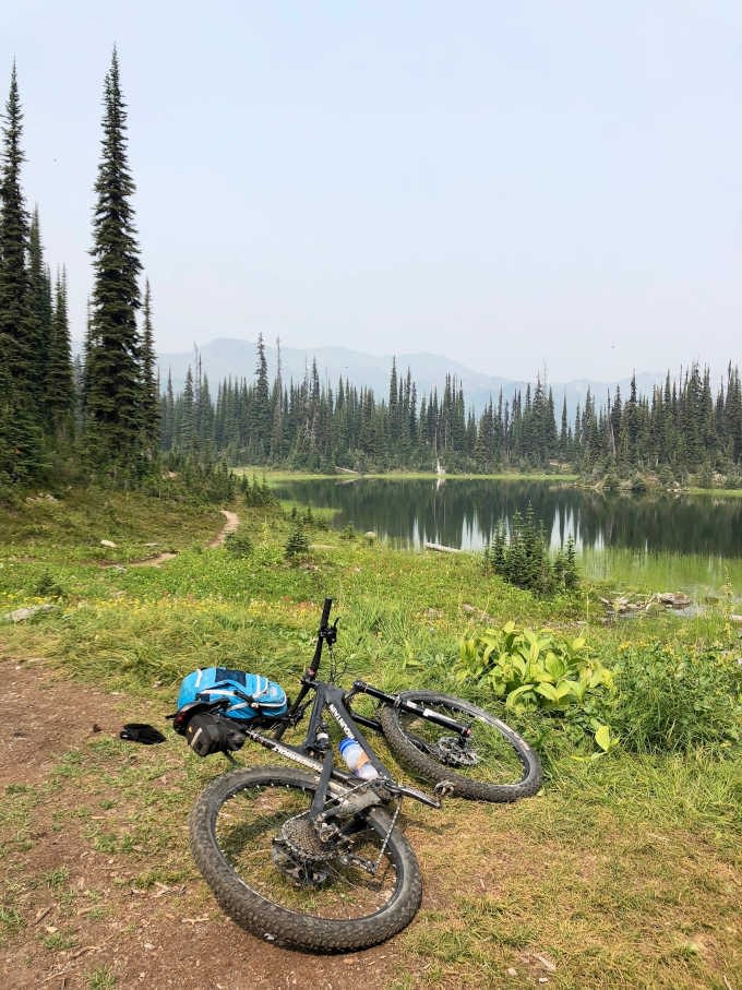
Standard Basin
Stop in at Lake Revelstoke for a refreshing swim on the way home! The boat launch used to access paddling over to Big Eddy Creek is a great option, providing quick easy lake access just after you are back on the highway heading home.
RAD adventure tip: Stop in at Lake Revelstoke for a refreshing swim on the way home! The boat launch used to access paddling over to Big Eddy Creek is a great option, providing quick easy lake access just after you are back on the highway heading home.
BETA
Cost: FREE
When to go: when the trail is snow free, usually mid-late July annually, until mid September. Check trailforks for current status.
Trip rating: B2 (C2 to add on Standard Basin)
Access: From Revelstoke, drive North on Highway 23N for 50km (about 45 minutes) until you reach the Keystone Standard FSR. The FSR will be labelled at the entrance. Drive up the FSR for 17km (about 45 minutes), until the end where you will arrive at the parking lot.
Turnoff from Highway 23: N51.386588°, W118.418588°
Trailhead: N51.395190°, W118.360499°